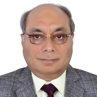
Biography

Arun K. Saraf
Indian Institute of Technology, India
Arun K. Saraf is Ph. D. (Remote Sensing) from University of Dundee, United Kingdom. Presently he is working as Professor (High Academic Grade at Level-15) in the Department of Earth Sciences, Indian Institute of Technology, Roorkee, and teaches courses on Geographic Information Systems (GIS), Remote Sensing, Digital Elevation Models and Applications, Digital Image Processing of Satellite Data, Geomorphology, Advanced Technical Communication etc. to under- and post-graduate students of Geological Technology and Applied Geology respectively. He was also been Head of Department of Earth Sciences between Jan. 2012 – Feb. 2015. He was first in the country to introduce GIS course to post-graduate students in the year 1990. In 1986, he was awarded “National Fellowship to Study Abroad†by Govt. of India for his doctoral degree.
Research Interest:
His research work in the field of remote sensing and GIS and its applications in earthquake, groundwater, fog etc. has earned him very high citation (Google Scholar: Total citation: 2769, h-index: 27, i10-index: 58).
Upcoming Conferences
International Conference on Otolaryngology & Case Reports
December 02, 2022
6th International Nanotechnology Conference & Expo
Dec 7-8, 2023
11th International Nursing Conference
Dec 7, 2023
5th International Chemistry Conference
April 24, 2025
7th International Conference on Geology & Earth Science
April 25, 2025
13th International Nursing Conference
April 23, 2025
